
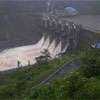
ISLAND ON ALERT AGAIN
- Rains ease today, but another wet spell looms after 6 August
- Major flood warnings issued as Mahaweli, Kelani and Kalu rivers swell
- Schools shut; Peradeniya University suspends classes amid landslide fears
- One dead, dozens rescued as authorities prepare for possible evacuations
Although the current spell of heavy rain is expected to ease by this afternoon (4), another period of rainfall is likely from around 6 August due to changes in wind patterns associated with a developing typhoon over the Pacific Ocean, Meteorology Department Director General Ajith Wijemannage said yesterday (3).“We expect this atmospheric disturbance to weaken by tomorrow afternoon. After that, rainfall is likely to decrease,” he said. However, he warned that the respite would be short-lived.
“Once that system becomes active around 6 August, wind currents are expected to strengthen. As a result, we expect some rainfall for a few days afterwards, particularly along the western slopes of the Central Highlands. High atmospheric moisture combined with stronger winds resulted in heavy showers across parts of Nuwara Eliya, Kandy, Kegalle and Ratnapura.”“We expected rainfall to be lower than the August average, especially in the Western and Sabaragamuwa Provinces. But, it is difficult to forecast September because there is considerable uncertainty,” he said. He explained that changing conditions over the Pacific Ocean, possible atmospheric disturbances over the Bay of Bengal and the transition towards the end of the South-West monsoon all contributed to the uncertainty surrounding September’s weather outlook.
“We said that September is uncertain, but we expect rainfall to increase during that period,” Wijemannage said adding that the Department had not specifically forecast significant rainfall for August, although active and inactive phases of the South-West monsoon have occurred during the month in previous years. “There have been occasions in previous years when the South-West monsoon became active during August and brought rain. This year, because we are in an El Niño condition, we did not expect such rainfall,” he said.
However, he said that an unexpected disturbance developed in the middle atmosphere, creating favourable conditions for rain. “Atmospheric moisture levels are high, and stronger winds carried that moisture towards the Central Highlands. That is why the heaviest rainfall was recorded in the Central Highlands. The heaviest showers are experienced in parts of the Nuwara Eliya, Kandy, Kegalle and Ratnapura Districts. He said that rain is expected to continue today morning in parts of the Kandy and Nuwara Eliya Districts, and the Sabaragamuwa and Western Provinces.
Speaking further, Wijemannage said the Department is closely monitoring a typhoon that is currently developing south of Japan over the Pacific Ocean. “Once that system becomes active around 6 August, wind currents are expected to strengthen. As a result, we expect some rainfall for a few days after 6 August, particularly along the western slopes of the Central Highlands,” he said, and added that the Sabaragamuwa Province and the Kandy and Nuwara Eliya Districts are expected to receive the highest amounts of rainfall during that period.
Meanwhile, authorities remain on high alert after between 70 mm and more than 200 mm of rain fell across parts of the island, causing river levels to rise rapidly and prompting flood and landslide warnings across several districts. The Mahaweli, Kelani and Kalu river basins are being closely monitored, with residents in vulnerable downstream areas urged to remain vigilant.